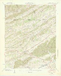
1939 Map of Blountville
USGS Topo · Published 1939About this map
Blountville serves as the focal point of this 1930s survey, centered around the Court House as the seat of local government. The landscape is defined by a series of parallel ridges, including Akard Ridge, Dishner Ridge, and Beck Ridge, which channeled development into the valleys of Reedy Creek and Beaver Creek. The map documents a dense network of early rural institutions, from schools like the Mill Point Sch and Ferndale Sch to congregational centers such as Booher Chapel and Elizabeth Chapel.
Find a feature on this map
44 named features on this map. Tap any name to fly to it.
Don’t see what you’re looking for? This feature index may not catch every label — zoom into the map to look around manually.
Map Details
Editions of this 1939 Blountville Map
2 editions found
Other maps of this area

1891 · Roan Mountain
USGS Topo · 1:125,000

1894 · Roan Mountain
USGS Topo · 1:125,000

1897 · Bristol
USGS Topo · 1:125,000

1902 · Bristol
USGS Topo · 1:125,000

1904 · Roan Mountain
USGS Topo · 1:125,000

1934 · Wallace
USGS Topo · 1:24,000

1934 · Bristol
USGS Topo · 1:24,000

1935 · Hilton
USGS Topo · 1:24,000

1935 · Watauga Valley
USGS Topo · 1:48,000

1935 · Mendota
USGS Topo · 1:24,000