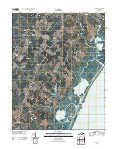
2011 Map of Bloxom
USGS Topo · Published 2011About this map
Arbuckle Neck and the intricate coastal marshes of the Atlantic Ocean shore define the eastern edge of this Accomack County landscape. This 2011 survey illustrates a well-established rural pattern where small settlements like Bloxom and Nelsonia are oriented along the inland road corridors, specifically the 13 highway. The map provides significant detail for genealogists, marking family-named sites such as Wessells Cemetery and Bloxom Cemetery, alongside essential civic hubs including the Mears Post Office and Mappsville Post Office. Further south, the terrain transitions into the distinct Gargathy Neck and Whites Neck, reaching toward the complex waterways of Kegotank Bay and Gargathy Bay. This environment, shaped by features like Wire Passage and the Metompkin Islands, highlights a coastal economy and lifestyle deeply tied to the inlets and landings of the Virginia Eastern Shore.
Find a feature on this map
44 named features on this map. Tap any name to fly to it.
Don’t see what you’re looking for? This feature index may not catch every label — zoom into the map to look around manually.
Map Details
Editions of this 2011 Bloxom Map
This is the sole edition of this map. No revisions or reprints were ever made.
Other maps of this area

1931 · Accomac
USGS Topo · 1:48,000

1935 · Accomac
USGS Topo · 1:62,500

1942 · Mappsville
USGS Topo · 1:24,000

1942 · Wallops Island
USGS Topo · 1:24,000

1942 · Saxis
USGS Topo · 1:24,000

1942 · Parksley
USGS Topo · 1:24,000

1943 · Parksley
USGS Topo · 1:31,680

1943 · Saxis
USGS Topo · 1:31,680

1943 · Mappsville
USGS Topo · 1:31,680

1943 · Chincoteague West
USGS Topo · 1:31,680