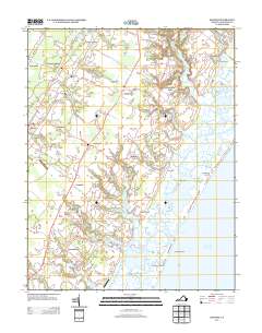
2013 Map of Bloxom
USGS Topo · Published 2013About this map
The salt marshes and barrier islands of the Eastern Shore dominate this early 21st-century landscape. The intricate interface between land and water is defined by labyrinthine waterways such as Kegotank Bay, Gargathy Inlet, and Mud Narrows. The topography here is profoundly flat, shaped by coastal dynamics that created the Metompkin Islands and Assawoman Island. Inland, the settlement pattern follows a linear path along the Lankford Hwy corridor, where crossroads communities like Nelsonia and Gargatha serve as focal points for the surrounding agricultural lands.
Find a feature on this map
123 named features on this map. Tap any name to fly to it.
Don’t see what you’re looking for? This feature index may not catch every label — zoom into the map to look around manually.
Map Details
Editions of this 2013 Bloxom Map
This is the sole edition of this map. No revisions or reprints were ever made.
Other maps of this area

1931 · Accomac
USGS Topo · 1:48,000

1935 · Accomac
USGS Topo · 1:62,500

1942 · Mappsville
USGS Topo · 1:24,000

1942 · Wallops Island
USGS Topo · 1:24,000

1942 · Saxis
USGS Topo · 1:24,000

1942 · Parksley
USGS Topo · 1:24,000

1943 · Parksley
USGS Topo · 1:31,680

1943 · Saxis
USGS Topo · 1:31,680

1943 · Mappsville
USGS Topo · 1:31,680

1943 · Chincoteague West
USGS Topo · 1:31,680