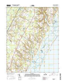
2016 Map of Bloxom
USGS Topo · Published 2016About this map
Assawoman Island and the complex tidal landscape of the Eastern Shore dominate this detailed survey of Accomack County. The map captures a transition from the structured agricultural and residential corridors along the main highway through Nelsonia and Mappsville to the intricate marshlands and waterways of Gargatha Bay and Kegotank Bay. The geographic pattern reveals how early settlement clung to higher ground, leaving the coastal margins to features like Egg Marsh and Wire Passage.
Find a feature on this map
124 named features on this map. Tap any name to fly to it.
Don’t see what you’re looking for? This feature index may not catch every label — zoom into the map to look around manually.
Map Details
Editions of this 2016 Bloxom Map
This is the sole edition of this map. No revisions or reprints were ever made.
Other maps of this area

1931 · Accomac
USGS Topo · 1:48,000

1935 · Accomac
USGS Topo · 1:62,500

1942 · Mappsville
USGS Topo · 1:24,000

1942 · Wallops Island
USGS Topo · 1:24,000

1942 · Saxis
USGS Topo · 1:24,000

1942 · Parksley
USGS Topo · 1:24,000

1943 · Parksley
USGS Topo · 1:31,680

1943 · Saxis
USGS Topo · 1:31,680

1943 · Mappsville
USGS Topo · 1:31,680

1943 · Chincoteague West
USGS Topo · 1:31,680