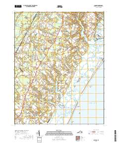
2019 Map of Bloxom
USGS Topo · Published 2019About this map
Nelsonia and Mappsville anchor the inland corridor of this Virginia coastal landscape, where a network of small settlements is defined by the labyrinthine inlets of the Atlantic coast. The eastern edge of the quadrangle reveals the complex maritime geography of Assawoman Island and the Metompkin Islands, separated from the mainland by the Northam Narrows and Gargathy Bay. This area illustrates the traditional Eastern Shore reliance on both land and sea, with established family sites like the Abbott Family Cem and the Wessells Cem located near the headwaters of tidal creeks such as Messongo Cr and Gargathy Creek.
Find a feature on this map
130 named features on this map. Tap any name to fly to it.
Don’t see what you’re looking for? This feature index may not catch every label — zoom into the map to look around manually.
Map Details
Editions of this 2019 Bloxom Map
This is the sole edition of this map. No revisions or reprints were ever made.
Other maps of this area

1931 · Accomac
USGS Topo · 1:48,000

1935 · Accomac
USGS Topo · 1:62,500

1942 · Mappsville
USGS Topo · 1:24,000

1942 · Wallops Island
USGS Topo · 1:24,000

1942 · Saxis
USGS Topo · 1:24,000

1942 · Parksley
USGS Topo · 1:24,000

1943 · Parksley
USGS Topo · 1:31,680

1943 · Saxis
USGS Topo · 1:31,680

1943 · Mappsville
USGS Topo · 1:31,680

1943 · Chincoteague West
USGS Topo · 1:31,680