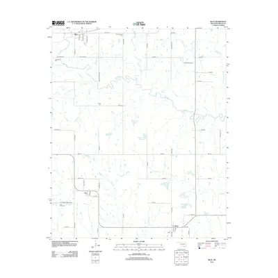
2012 Map of Blue
USGS Topo · Published 2012About this map
The Blue River winds through the heart of this Bryan County landscape, serving as a central geographic feature for several small Oklahoma communities. To the north, the settlement of Blue is situated along Old Hwy 70, while Utica and Albany occupy the southern reaches of the region. The map reveals a land defined by family-named landmarks and historical burial sites, including the Philadelphia Cem and Old Philadelphia Cem near the riverbanks, as well as the Burris Cem further south.
Find a feature on this map
68 named features on this map. Tap any name to fly to it.
Don’t see what you’re looking for? This feature index may not catch every label — zoom into the map to look around manually.
Map Details
Editions of this 2012 Blue Map
This is the sole edition of this map. No revisions or reprints were ever made.
Other maps of this area

1899 · Atoka
USGS Topo · 1:125,000

1900 · Atoka
USGS Topo · 1:125,000

1954 · Sherman
USGS Topo · 1:250,000

1957 · Wade
USGS Topo · 1:62,500

1957 · Ardmore
USGS Topo · 1:250,000

1958 · Durant
USGS Topo · 1:62,500

1958 · Sherman
USGS Topo · 1:250,000

1963 · Ardmore
USGS Topo · 1:250,000

1969 · Bokchito
USGS Topo · 1:24,000
1969 · Caddo South
USGS Topo · 1:24,000