
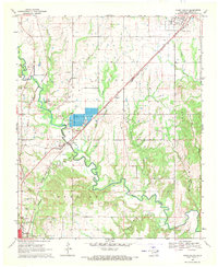
1969 Map of Bokchito
USGS Topo · Published 1971About this map
Bokchito serves as the primary hub of activity on this Bryan County survey, centered around the St Louis - San Francisco railroad and the local Cemetery. The landscape is defined by an intricate network of drainage, including Caddo Creek and the meandering Bokchito Creek, which transition into more rugged terrain near the Matoy area. Smaller named settlements and junctions like Sevenmile Corner, Pritchard, and Speairs provide important landmarks for local history researchers and genealogists tracing early family homesteads in the region.
Find a feature on this map
25 named features on this map. Tap any name to fly to it.
Don’t see what you’re looking for? This feature index may not catch every label — zoom into the map to look around manually.
Map Details
Editions of this 1969 Bokchito Map
This is the sole edition of this map. No revisions or reprints were ever made.
Other maps of this area

1899 · Atoka
USGS Topo · 1:125,000

1900 · Atoka
USGS Topo · 1:125,000

1954 · Sherman
USGS Topo · 1:250,000

1957 · Wade
USGS Topo · 1:62,500

1957 · Ardmore
USGS Topo · 1:250,000

1958 · Durant
USGS Topo · 1:62,500

1958 · Sherman
USGS Topo · 1:250,000

1963 · Ardmore
USGS Topo · 1:250,000

1969 · Caddo North
USGS Topo · 1:24,000
1969 · Caddo South
USGS Topo · 1:24,000