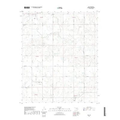
2018 Map of Blue
USGS Topo · Published 2018About this map
Blue River carves a winding path through this Bryan County landscape, anchoring a rural territory defined by the small settlements of Blue, Utica, and Albany. The map reflects a deeply rooted agrarian community where local history is preserved in small family and church burial grounds, including the Philadelphia Cem and the Old Philadelphia Cem. The terrain is marked by numerous water bodies like Fowler Lake and McGee Lake Number 1, alongside seasonal drainages such as Tuklo Cr and Bokchito Cr. A complex grid of rural roads, such as Red Bird Hollow Rd and Five Doe Rd, connects these dispersed homesteads and farms, illustrating the modern rural layout of south-central Oklahoma. The presence of multiple cemeteries near established watercourses suggests long-standing settlement patterns dating back to the area's earlier territorial history.
Find a feature on this map
63 named features on this map. Tap any name to fly to it.
Don’t see what you’re looking for? This feature index may not catch every label — zoom into the map to look around manually.
Map Details
Editions of this 2018 Blue Map
This is the sole edition of this map. No revisions or reprints were ever made.
Other maps of this area

1899 · Atoka
USGS Topo · 1:125,000

1900 · Atoka
USGS Topo · 1:125,000

1954 · Sherman
USGS Topo · 1:250,000

1957 · Wade
USGS Topo · 1:62,500

1957 · Ardmore
USGS Topo · 1:250,000

1958 · Durant
USGS Topo · 1:62,500

1958 · Sherman
USGS Topo · 1:250,000

1963 · Ardmore
USGS Topo · 1:250,000

1969 · Bokchito
USGS Topo · 1:24,000
1969 · Caddo South
USGS Topo · 1:24,000