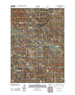
2011 Map of Blue Canyon
USGS Topo · Published 2011About this map
Auburn Cemetery serves as a quiet reminder of the regional history in this Baker County landscape, situated near the remnants of former water works like the Old Auburn Reservoir. The terrain is deeply etched by a complex drainage system including Blue Canyon, French Gulch, and Freezeout Gulch, reflecting the topographic character of the Blue Mountains. Modern infrastructure is anchored by Mason Dam on the Powder River, which manages water for the valley below through historical conveyances such as the Littlefield Ditch. While much of the land is managed through a network of Forest Service roads like NFD RD 7220 RD, the presence of landmarks like Auburn Sno-Park and numerous named gulches and reservoirs indicates a landscape heavily shaped by both recreation and historical resource management.
Find a feature on this map
40 named features on this map. Tap any name to fly to it.
Don’t see what you’re looking for? This feature index may not catch every label — zoom into the map to look around manually.
Map Details
Editions of this 2011 Blue Canyon Map
This is the sole edition of this map. No revisions or reprints were ever made.
Other maps of this area

1901 · Baker City
USGS Topo · 1:125,000

1901 · Sumpter
USGS Topo · 1:125,000

1955 · Baker
USGS Topo · 1:250,000

1955 · Canyon City
USGS Topo · 1:250,000

1959 · Baker
USGS Topo · 1:250,000

1959 · Canyon City
USGS Topo · 1:250,000

1967 · Baker
USGS Topo · 1:24,000

1967 · Dooley Mtn
USGS Topo · 1:24,000

1967 · Blue Canyon
USGS Topo · 1:24,000
1967 · Bowen Valley
USGS Topo · 1:24,000