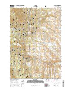
2017 Map of Blue Canyon
USGS Topo · Published 2017About this map
Whitman National Forest dominates this section of Baker County, where the topography transition from the high Elkhorn Ridge down toward the Powder River valley. The map preserves the legacy of the historic mining era through local names like California Gulch, Freezeout Gulch, and French Gulch. A central historical landmark is the Auburn Cem, located along Auburn Ln, serving as a silent reminder of the former gold-rush settlement that once served as the county seat. Water management is a defining characteristic of the landscape, evidenced by the intricate Littlefield Ditch and a network of storage sites including the Old Auburn Reservoir, Vogel Reservoir, and Haskell Reservoir. To the southwest, the modern footprint of Phillips Lake meets the riparian environment of Salisbury Marsh, illustrating the evolving use of the region's river systems.
Find a feature on this map
56 named features on this map. Tap any name to fly to it.
Don’t see what you’re looking for? This feature index may not catch every label — zoom into the map to look around manually.
Map Details
Editions of this 2017 Blue Canyon Map
This is the sole edition of this map. No revisions or reprints were ever made.
Other maps of this area

1901 · Baker City
USGS Topo · 1:125,000

1901 · Sumpter
USGS Topo · 1:125,000

1955 · Baker
USGS Topo · 1:250,000

1955 · Canyon City
USGS Topo · 1:250,000

1959 · Baker
USGS Topo · 1:250,000

1959 · Canyon City
USGS Topo · 1:250,000

1967 · Baker
USGS Topo · 1:24,000

1967 · Dooley Mtn
USGS Topo · 1:24,000

1967 · Blue Canyon
USGS Topo · 1:24,000
1967 · Bowen Valley
USGS Topo · 1:24,000