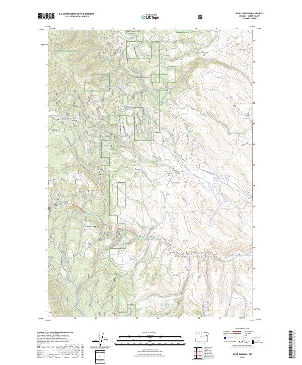
2023 Map of Blue Canyon
USGS Topo · Published 2023About this map
Whitman National Forest dominates the high country of this quadrangle, where the Elkhorn Mountains and Elkhorn Ridge rise above a landscape defined by historical water management. Traces of the region's mining and ranching legacy are visible in the numerous reservoirs and gulches that score the terrain, including Old Auburn Reservoir, Haskell Reservoir, and Vogel Reservoir. Near the center of the sheet, the Auburn Cem stands as a quiet marker of the area's former population centers along Auburn Ln. To the south, the Powder River meanders through the valley toward Salisbury Marsh, joined by seasonal tributaries like Webfoot Creek and Poker Creek. The infrastructure of the forest is well-represented by routes such as NFD Road 7140 RD and the Auburn-Deer Creek Snowmobile Trl, which navigate the steep elevations near Black Mtn.
Find a feature on this map
52 named features on this map. Tap any name to fly to it.
Don’t see what you’re looking for? This feature index may not catch every label — zoom into the map to look around manually.
Map Details
Editions of this 2023 Blue Canyon Map
This is the sole edition of this map. No revisions or reprints were ever made.
Other maps of this area

1901 · Baker City
USGS Topo · 1:125,000

1901 · Sumpter
USGS Topo · 1:125,000

1955 · Baker
USGS Topo · 1:250,000

1955 · Canyon City
USGS Topo · 1:250,000

1959 · Baker
USGS Topo · 1:250,000

1959 · Canyon City
USGS Topo · 1:250,000

1967 · Baker
USGS Topo · 1:24,000

1967 · Dooley Mtn
USGS Topo · 1:24,000

1967 · Blue Canyon
USGS Topo · 1:24,000
1967 · Bowen Valley
USGS Topo · 1:24,000