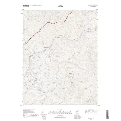
2019 Map of Blue Creek
USGS Topo · Published 2019About this map
Elk River serves as the central artery for this region of Kanawha County, where the Elk River Water Trail follows the winding valley through established riverfront communities. The map captures the dense network of hillside settlements and narrow hollows, featuring the prominent junction at Blue Creek and the river crossing at Jarretts Ford. Notable for genealogists, the landscape is dotted with numerous family-named burial grounds, including Walker Cem, Reynolds Cem, and Jarrett Cem, many situated on the ridges overlooking the water. The integration of modern infrastructure like the Elk River Veterans Bridge alongside traditional place names like Pinch and Falling Rock illustrates the area's continued role as a residential corridor north of Charleston. Smaller settlements such as Coco, Schrader, and Pentacre are found deeper in the interior, clustered along the many forks of Blue Creek and Upper Threemile Fork.
Find a feature on this map
70 named features on this map. Tap any name to fly to it.
Don’t see what you’re looking for? This feature index may not catch every label — zoom into the map to look around manually.
Map Details
Editions of this 2019 Blue Creek Map
This is the sole edition of this map. No revisions or reprints were ever made.
Other maps of this area

1897 · Kanawha Falls
USGS Topo · 1:125,000

1899 · Charleston
USGS Topo · 1:125,000

1900 · Kanawha Falls
USGS Topo · 1:125,000

1901 · Kanawha Falls
USGS Topo · 1:125,000

1906 · Kenna
USGS Topo · 1:62,500

1906 · Walton
USGS Topo · 1:62,500

1907 · Kenna
USGS Topo · 1:62,500

1907 · Walton
USGS Topo · 1:62,500

1907 · Clendenin
USGS Topo · 1:62,500

1909 · Charleston
USGS Topo · 1:62,500