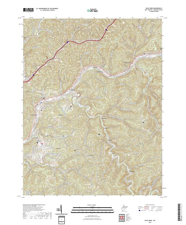
2023 Map of Blue Creek
USGS Topo · Published 2023About this map
The Elk River winds through the heart of this terrain, anchoring a series of riverbank settlements including Walgrove, Youngs Bottom, and Falling Rock. This corridor is defined by the narrow valley floors where the Elk River Rd and the Walgrove Rd rail line parallel the water, connecting the community of Blue Creek with neighboring Jarretts Ford and Elkview. The map reveals a high density of family-named cemeteries tucked into the hollows and ridges, such as Price Cem, Jarrett Cem, and Vickers Cem, providing significant data for genealogical research.
Find a feature on this map
133 named features on this map. Tap any name to fly to it.
Don’t see what you’re looking for? This feature index may not catch every label — zoom into the map to look around manually.
Map Details
Editions of this 2023 Blue Creek Map
This is the sole edition of this map. No revisions or reprints were ever made.
Other maps of this area

1897 · Kanawha Falls
USGS Topo · 1:125,000

1899 · Charleston
USGS Topo · 1:125,000

1900 · Kanawha Falls
USGS Topo · 1:125,000

1901 · Kanawha Falls
USGS Topo · 1:125,000

1906 · Kenna
USGS Topo · 1:62,500

1906 · Walton
USGS Topo · 1:62,500

1907 · Kenna
USGS Topo · 1:62,500

1907 · Walton
USGS Topo · 1:62,500

1907 · Clendenin
USGS Topo · 1:62,500

1909 · Charleston
USGS Topo · 1:62,500