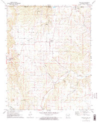
1972 Map of Blue Eye
USGS Topo · Published 1974About this map
The Missouri-Arkansas state line bisects this landscape, running directly through the community of Blue Eye. This 1970s survey captures the rural character of Stone and Carroll Counties, where the land is defined by a dense network of hollows and creek beds. Significant landmarks such as Cosmic Cavern near Maple and the Mark Twain National Forest along the northern border indicate a region shaped by karst topography and timber. The map provides a detailed view of local genealogy through numerous family and community sites, including Boyd Cemetery and New Home Cemetery. Transportation is oriented toward small hubs like Oakgrove and Cisco, with several country churches like Fanning Church and Hale Church serving as focal points for the upland settlements nestled between Yocum Creek and Indian Creek.
Find a feature on this map
31 named features on this map. Tap any name to fly to it.
Don’t see what you’re looking for? This feature index may not catch every label — zoom into the map to look around manually.
Map Details
Editions of this 1972 Blue Eye Map
2 editions found
Other maps of this area

1900 · Eureka Springs
USGS Topo · 1:125,000

1901 · Eureka Springs
USGS Topo · 1:125,000

1904 · Harrison
USGS Topo · 1:125,000

1905 · Harrison
USGS Topo · 1:125,000

1907 · Forsyth
USGS Topo · 1:125,000

1927 · Shell Knob
USGS Topo · 1:62,500

1945 · Harrison
USGS Topo · 1:250,000

1949 · Harrison
USGS Topo · 1:250,000

1950 · Shell Knob
USGS Topo · 1:62,500

1954 · Harrison
USGS Topo · 1:250,000