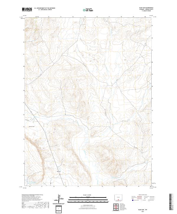
2021 Map of Blue Gap
USGS Topo · Published 2021About this map
Blue Gap serves as the central focal point for this section of Carbon County, where a network of unpaved tracks and seasonal drainages define the high desert landscape. The terrain is characterized by the broad, level expanse of Mexican Flats and a complex system of creek beds including Muddy Cr, Cow Cr, and Wild Cow Cr.
Find a feature on this map
14 named features on this map. Tap any name to fly to it.
Don’t see what you’re looking for? This feature index may not catch every label — zoom into the map to look around manually.
Map Details
Editions of this 2021 Blue Gap Map
This is the sole edition of this map. No revisions or reprints were ever made.
Other maps of this area

1954 · Rawlins
USGS Topo · 1:250,000

1957 · Baggs
USGS Topo · 1:62,500

1957 · Doty Mountain
USGS Topo · 1:62,500

1958 · Rawlins
USGS Topo · 1:250,000

1962 · Rawlins
USGS Topo · 1:250,000

1967 · Rawlins
USGS Topo · 1:250,000

1970 · Mexican Flats
USGS Topo · 1:24,000
1970 · Flat Top Mountain
USGS Topo · 1:24,000

1970 · Duck Lake
USGS Topo · 1:24,000
1975 · Baggs NW
USGS Topo · 1:24,000