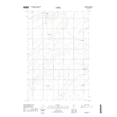
2019 Map of Blue Grass
USGS Topo · Published 2019About this map
Sebeka anchors the northwestern corner of this central Minnesota landscape, where the town's grid meets the agricultural reaches of Wadena County. The terrain is defined by a dense network of township and county roads, such as Co Rd 9 and 121st Ave, cutting through a mosaic of wetlands and prairie flats. The slow-moving Hay Cr meanders across the eastern half of the sheet, reflecting the drainage patterns of the Red River Valley's edge. Near the southern settlement of Blue Grass, local history is preserved at Saint Huberts Cem and Greenhill Cem, which serve as permanent records of the early families who established these rural townships. The map illustrates a strictly sectioned landscape, largely defined by the Public Land Survey System boundaries like t136n r35w, which dictate the placement of farmstead access roads and regional transit routes like Co Hwy 10.
Find a feature on this map
37 named features on this map. Tap any name to fly to it.
Don’t see what you’re looking for? This feature index may not catch every label — zoom into the map to look around manually.
Map Details
Editions of this 2019 Blue Grass Map
This is the sole edition of this map. No revisions or reprints were ever made.
Other maps of this area

1953 · Brainerd
USGS Topo · 1:250,000

1957 · Brainerd
USGS Topo · 1:250,000

1958 · Brainerd
USGS Topo · 1:250,000

1965 · Brainerd
USGS Topo · 1:250,000

1966 · Aldrich North
USGS Topo · 1:24,000

1969 · Sebeka SW
USGS Topo · 1:24,000

1969 · Sebeka
USGS Topo · 1:24,000

1969 · Sebeka NW
USGS Topo · 1:24,000

1969 · Wadena
USGS Topo · 1:24,000

1969 · Verndale
USGS Topo · 1:24,000