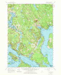
1957 Map of Blue Hill
USGS Topo · Published 1971About this map
The prominent peak of Blue Hill overlooks a complex coastal landscape of peninsulas and islands along the Maine coast during the late 1950s. This survey detail reveals the intricate maritime and rural character of Hancock County, where the rugged shoreline of Blue Hill Harbor meets the inland waters of Salt Pond and Walker Pond. The distribution of coastal settlements like Sargentville, Brooklin, and Haven highlights a long-standing orientation toward the sea, particularly around the Benjamin River and Eggemoggin Reach.
Find a feature on this map
173 named features on this map. Tap any name to fly to it.
Don’t see what you’re looking for? This feature index may not catch every label — zoom into the map to look around manually.
Map Details
Editions of this 1957 Blue Hill Map
4 editions found
Other maps of this area

1900 · Orland
USGS Topo · 1:62,500

1900 · Bucksport
USGS Topo · 1:62,500

1902 · Bucksport
USGS Topo · 1:62,500

1902 · Castine
USGS Topo · 1:62,500

1904 · Deer Isle
USGS Topo · 1:62,500

1904 · Castine
USGS Topo · 1:62,500

1904 · Mount Desert
USGS Topo · 1:62,500

1904 · Swan Island
USGS Topo · 1:62,500

1904 · Bluehill
USGS Topo · 1:62,500

1904 · Vinalhaven
USGS Topo · 1:62,500