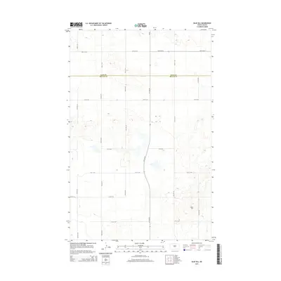
2014 Map of Blue Hill
USGS Topo · Published 2014About this map
Blue Hill rises as a prominent landmark in this prairie landscape, situated near the boundary where Ward Co and McLean Co meet. The terrain is characterized by numerous small potholes and wetlands typical of the North Dakota glacial till plain, showing a rural environment dominated by a vast grid of section-line roads. Major thoroughfares such as 359th Ave Sw and 24th St Nw facilitate travel across these agricultural expanses, while Highway 28 cuts a north-south path through the center of the sheet. This 2014 survey documents the enduring pastoral structure of the region, where the primary human footprint is found in the meticulous geometry of the township and range surveying system.
Find a feature on this map
18 named features on this map. Tap any name to fly to it.
Don’t see what you’re looking for? This feature index may not catch every label — zoom into the map to look around manually.
Map Details
Editions of this 2014 Blue Hill Map
This is the sole edition of this map. No revisions or reprints were ever made.
Other maps of this area

1954 · McClusky
USGS Topo · 1:250,000

1956 · Emmet NE
USGS Topo · 1:24,000

1956 · Blackwater Lake
USGS Topo · 1:24,000

1956 · Blue Hill
USGS Topo · 1:24,000

1956 · Emmet
USGS Topo · 1:24,000

1956 · Douglas West
USGS Topo · 1:24,000

1956 · Roseglen
USGS Topo · 1:24,000

1958 · McClusky
USGS Topo · 1:250,000

1980 · Lake Vernon
USGS Topo · 1:24,000

1980 · Makoti
USGS Topo · 1:24,000