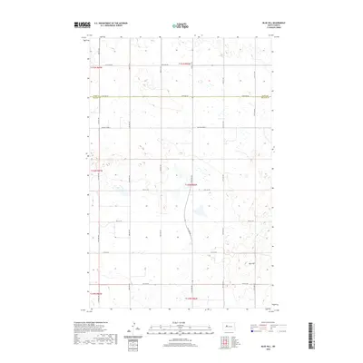
2020 Map of Blue Hill
USGS Topo · Published 2020About this map
Blue Hill rises as a prominent landmark in this prairie landscape along the border of Ward and McLean Counties. This 2020 survey documents the systematic Section-Township-Range organization of the North Dakota interior, where a network of section-line roads like 373rd Ave SW and 51st Ave NW partition the land into agricultural blocks. The map reveals the characteristic hydrology of the Missouri Plateau, dotted with numerous small, unnamed prairie potholes and wetlands that lie between the low rises. These water bodies are most concentrated in the northern sections, such as those accessed by 359th Ave SW. While the area is primarily rural, the corridor along McLean Co Hwy 2 serves as a primary east-west artery through this high-plains terrain.
Find a feature on this map
27 named features on this map. Tap any name to fly to it.
Don’t see what you’re looking for? This feature index may not catch every label — zoom into the map to look around manually.
Map Details
Editions of this 2020 Blue Hill Map
This is the sole edition of this map. No revisions or reprints were ever made.
Other maps of this area

1954 · McClusky
USGS Topo · 1:250,000

1956 · Emmet NE
USGS Topo · 1:24,000

1956 · Blackwater Lake
USGS Topo · 1:24,000

1956 · Blue Hill
USGS Topo · 1:24,000

1956 · Emmet
USGS Topo · 1:24,000

1956 · Douglas West
USGS Topo · 1:24,000

1956 · Roseglen
USGS Topo · 1:24,000

1958 · McClusky
USGS Topo · 1:250,000

1980 · Lake Vernon
USGS Topo · 1:24,000

1980 · Makoti
USGS Topo · 1:24,000