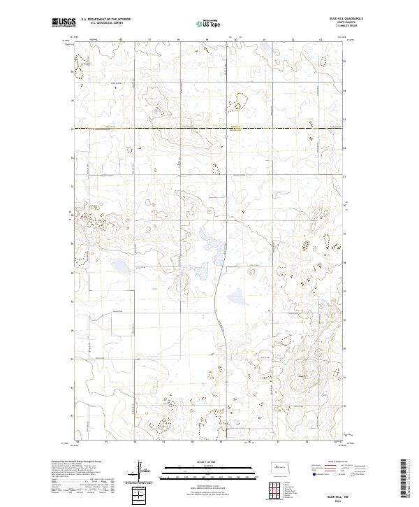
2024 Map of Blue Hill
USGS Topo · Published 2024About this map
McLean County Waterfowl Production Area dominates the central landscape of this North Dakota prairie region, illustrating the protected wetland and grassland habitat vital to the area's ecology. Situated along the boundary where Ward Co meets McLean Co, the terrain is defined by the prominent rise of Blue Hill, which provides a distinct vertical contrast to the surrounding depressions. The map reveals a strictly organized grid of rural infrastructure, including McLean Co Hwy 2 and an extensive network of range roads like 240th St SW and 54th Ave NW. This survey of the Missouri Plateau region showcases a modern landscape of agricultural sections and conservation lands, where the natural prairie potholes and topographic high points remain the primary landmarks amidst the survey lines.
Find a feature on this map
28 named features on this map. Tap any name to fly to it.
Don’t see what you’re looking for? This feature index may not catch every label — zoom into the map to look around manually.
Map Details
Editions of this 2024 Blue Hill Map
This is the sole edition of this map. No revisions or reprints were ever made.
Other maps of this area

1954 · McClusky
USGS Topo · 1:250,000

1956 · Emmet NE
USGS Topo · 1:24,000

1956 · Blackwater Lake
USGS Topo · 1:24,000

1956 · Blue Hill
USGS Topo · 1:24,000

1956 · Emmet
USGS Topo · 1:24,000

1956 · Douglas West
USGS Topo · 1:24,000

1956 · Roseglen
USGS Topo · 1:24,000

1958 · McClusky
USGS Topo · 1:250,000

1980 · Lake Vernon
USGS Topo · 1:24,000

1980 · Makoti
USGS Topo · 1:24,000