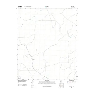
2010 Map of Blue Hills
USGS Topo · Published 2010About this map
Flood Homestead and the isolated ranching outposts of Sidwell and McPhual Ranch anchor this 2010 study of the high desert landscape in Catron County. The terrain is defined by the prominent Blue Hills and Taylor Hills, while water resources are concentrated at points like San Antone Lake and several man-made improvements including West Hubbell Tank and Flood Tank. This map documents a modern network of remote county roads, such as County Rd-A078 and County Rd-A050, which connect these distant homesteads and livestock tanks. The drainage patterns of McAllister Draw further illustrate the sparse, water-dependent geography of the region, providing a clear view of how land use and transit persist in this corner of New Mexico.
Find a feature on this map
16 named features on this map. Tap any name to fly to it.
Don’t see what you’re looking for? This feature index may not catch every label — zoom into the map to look around manually.
Map Details
Editions of this 2010 Blue Hills Map
This is the sole edition of this map. No revisions or reprints were ever made.
Other maps of this area

1954 · Saint Johns
USGS Topo · 1:250,000

1957 · Saint Johns
USGS Topo · 1:250,000

1958 · Saint Johns
USGS Topo · 1:250,000

1962 · Saint Johns
USGS Topo · 1:250,000

1967 · Omega
USGS Topo · 1:24,000
1967 · Tres Lagunas
USGS Topo · 1:24,000
1967 · York Ranch SE
USGS Topo · 1:24,000
1967 · Red Flats
USGS Topo · 1:24,000

1967 · Adams Diggings
USGS Topo · 1:24,000

1967 · Blue Hills
USGS Topo · 1:24,000