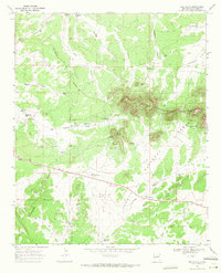
1967 Map of Red Flats
USGS Topo · Published 1971About this map
The Sawtooth Mountains dominate the northeastern landscape of this New Mexico quadrangle, rising above the surrounding high plains and draws. This high-altitude terrain is defined by the Continental Divide, which runs diagonally across the western half of the map, separating drainage patterns like Still Newton Draw and Pino Draw. The area’s ranching and livestock history is evident in the dense network of named water sources, such as Glasscock Tank, McWhorter Tank, and Bennett Tank, which sustained life in these arid uplands.
Find a feature on this map
42 named features on this map. Tap any name to fly to it.
Don’t see what you’re looking for? This feature index may not catch every label — zoom into the map to look around manually.
Map Details
Editions of this 1967 Red Flats Map
This is the sole edition of this map. No revisions or reprints were ever made.
Other maps of this area

1954 · Saint Johns
USGS Topo · 1:250,000

1954 · Socorro
USGS Topo · 1:250,000

1957 · Saint Johns
USGS Topo · 1:250,000

1958 · Socorro
USGS Topo · 1:250,000

1958 · Saint Johns
USGS Topo · 1:250,000

1962 · Socorro
USGS Topo · 1:250,000

1962 · Saint Johns
USGS Topo · 1:250,000

1964 · Third Canyon
USGS Topo · 1:24,000
1964 · Madre Mountain
USGS Topo · 1:24,000

1964 · Crosby Springs
USGS Topo · 1:24,000