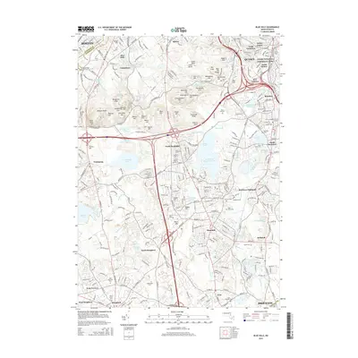
2015 Map of Blue Hills
USGS Topo · Published 2015About this map
Adams National Historical Park stands as a focal point in this 2015 study of the southern suburban perimeter of Boston. The landscape is defined by the significant rise of the Blue Hill Range, featuring numerous summits like Great Blue Hill and Chickatawbut Hill that divide the residential development of Quincy, Milton, and Randolph. The map reveals a complex network of suburban expansion, with densely settled areas like South Quincy and South Braintree transitioning into the protected woodlands of the hills. Large water bodies such as the Great Pond Upper Reservoir and Ponkapoag Pond emphasize the region's historic reliance on local watersheds. Local genealogists will find several burial grounds noted, including Blue Hill Cem and Saint Marys Cem, alongside landmarks such as Curry Coll and various neighborhoods like North Stoughton and Braintree Highlands.
Find a feature on this map
308 named features on this map. Tap any name to fly to it.
Don’t see what you’re looking for? This feature index may not catch every label — zoom into the map to look around manually.
Map Details
Editions of this 2015 Blue Hills Map
This is the sole edition of this map. No revisions or reprints were ever made.
Other maps of this area

1885 · Abington
USGS Topo · 1:62,500

1886 · Dedham
USGS Topo · 1:62,500

1888 · Abington
USGS Topo · 1:62,500

1892 · Boston Bay
USGS Topo · 1:62,500

1893 · Abington
USGS Topo · 1:62,500

1893 · Boston
USGS Topo · 1:62,500

1894 · Dedham
USGS Topo · 1:62,500

1903 · Boston
USGS Topo · 1:62,500

1903 · Boston Bay
USGS Topo · 1:62,500

1919 · Dedham
USGS Topo · 1:62,500