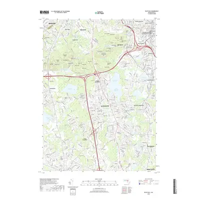
2018 Map of Blue Hills
USGS Topo · Published 2018About this map
Adams National Historical Park anchors the northeast corner of this landscape, marking the intersection of American political history and the local terrain. The rugged uplift of the Blue Hills dominates the central and western portions of the quadrangle, featuring prominent summits like Great Blue Hill, Chickatawbut Hill, and Hancock Hill. This area is a complex network of conservation land and outdoor recreation, containing Camp Sayre and the sprawling Blue Hills Reservoir. The topography transitions from these steep ridges into the developed residential and civic centers of Quincy, Randolph, and Holbrook. Substantial water resources, including the Great Pond Reservoir and Great Pond Upper Reservoir, are prominent features that reflect the region's managed municipal water systems and historical land use. Numerous cemeteries, such as the Christ Church Burial Ground and Blue Hill Cem, provide valuable reference points for genealogists tracking family roots across this part of Norfolk County.
Find a feature on this map
119 named features on this map. Tap any name to fly to it.
Don’t see what you’re looking for? This feature index may not catch every label — zoom into the map to look around manually.
Map Details
Editions of this 2018 Blue Hills Map
This is the sole edition of this map. No revisions or reprints were ever made.
Other maps of this area

1885 · Abington
USGS Topo · 1:62,500

1886 · Dedham
USGS Topo · 1:62,500

1888 · Abington
USGS Topo · 1:62,500

1892 · Boston Bay
USGS Topo · 1:62,500

1893 · Abington
USGS Topo · 1:62,500

1893 · Boston
USGS Topo · 1:62,500

1894 · Dedham
USGS Topo · 1:62,500

1903 · Boston
USGS Topo · 1:62,500

1903 · Boston Bay
USGS Topo · 1:62,500

1919 · Dedham
USGS Topo · 1:62,500