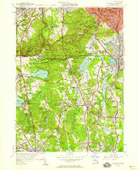
1946 Map of Blue Hills
USGS Topo · Published 1958About this map
Great Blue Hill and the surrounding Blue Hills Reservation dominate the northern landscape, anchoring a rugged terrain defined by peaks like Chickatawbut Hill and Hancock Hill. This 1946 revision shows a region in transition, where the wooded uplands meet the expanding residential and industrial corridors of Quincy, Braintree, and Randolph. The New York New Haven and Hartford RR provides a critical transportation spine through the southeastern corner, serving towns from Avon to Stoughton.
Find a feature on this map
114 named features on this map. Tap any name to fly to it.
Don’t see what you’re looking for? This feature index may not catch every label — zoom into the map to look around manually.
Map Details
Editions of this 1946 Blue Hills Map
This is the sole edition of this map. No revisions or reprints were ever made.
Other maps of this area

1885 · Abington
USGS Topo · 1:62,500

1886 · Dedham
USGS Topo · 1:62,500

1888 · Abington
USGS Topo · 1:62,500

1892 · Boston Bay
USGS Topo · 1:62,500

1893 · Abington
USGS Topo · 1:62,500

1893 · Boston
USGS Topo · 1:62,500

1894 · Dedham
USGS Topo · 1:62,500

1903 · Boston
USGS Topo · 1:62,500

1903 · Boston Bay
USGS Topo · 1:62,500

1919 · Dedham
USGS Topo · 1:62,500