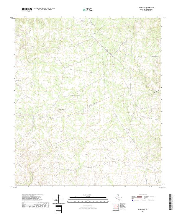
2022 Map of Blue Hills
USGS Topo · Published 2022About this map
Blue Hills occupies a high-elevation landscape in Val Verde County, where the terrain is defined by a complex network of deep drainage cuts and high ridges. This 2022 survey captures the modern road infrastructure necessary to navigate such a fragmented landscape, primarily focused on Ranch Rd 1024 and FM 1024. These routes connect the isolated high points and ranch lands between several significant geographic depressions, including the prominent Lewis Canyon to the west and Sycamore Canyon toward the east. The map illustrates how human activity and travel remain closely tied to the natural contours of the land, with Blue Hill Rd winding through the center of the quadrangle. Significant drainage features like Duncan Draw in the north and the nearby Wallace Canyon indicate the movement of water through this arid region, showing the erosion patterns that have shaped the territory over time.
Find a feature on this map
8 named features on this map. Tap any name to fly to it.
Don’t see what you’re looking for? This feature index may not catch every label — zoom into the map to look around manually.
Map Details
Editions of this 2022 Blue Hills Map
This is the sole edition of this map. No revisions or reprints were ever made.
Other maps of this area

1943 · Shumla
USGS Topo · 1:62,500

1944 · Baker Crossing
USGS Topo · 1:62,500

1954 · Sonora
USGS Topo · 1:250,000

1958 · Sonora
USGS Topo · 1:250,000

1958 · Del Rio
USGS Topo · 1:250,000

1964 · Del Rio
USGS Topo · 1:250,000

1970 · Everett Canyon
USGS Topo · 1:24,000

1970 · Steel Star Draw
USGS Topo · 1:24,000

1970 · Sycamore Canyon
USGS Topo · 1:24,000

1970 · Blue Hills
USGS Topo · 1:24,000