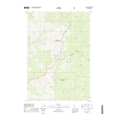
2020 Map of Blue Joint
USGS Topo · Published 2020About this map
Bitterroot National Forest and Salmon National Forest meet along the high divide of the Bitterroot Mountains, where the state boundary separates Idaho and Montana. The terrain is defined by dramatic elevation changes, from the prominent summit of Squaw Peak to the high-altitude basins containing Line Lake and Reynolds Lake. This survey illustrates a wilderness shaped by water and high ridges, where Storm Creek and Blue Joint Cr carve deep drainages through the landscape. Primitive access routes like the Square Top-West Horse trail and Divide S follow the natural contours of the mountain crests. The map captures the remote character of the borderlands, including specific watering points like Two Buck Spring and the open expanse of Storm Creek Flat, providing a detailed view of the natural features that have guided travelers through these forests for generations.
Find a feature on this map
48 named features on this map. Tap any name to fly to it.
Don’t see what you’re looking for? This feature index may not catch every label — zoom into the map to look around manually.
Map Details
Editions of this 2020 Blue Joint Map
This is the sole edition of this map. No revisions or reprints were ever made.
Other maps of this area

1956 · Elk City
USGS Topo · 1:250,000

1960 · Elk City
USGS Topo · 1:250,000

1960 · Painted Rocks Lake
USGS Topo · 1:62,500

1960 · Shoup
USGS Topo · 1:62,500

1962 · Wood Hump
USGS Topo · 1:24,000

1962 · Beaver Jack Mtn
USGS Topo · 1:24,000

1962 · Blue Joint
USGS Topo · 1:24,000

1962 · Square Top
USGS Topo · 1:24,000

1962 · Horse Creek Butte
USGS Topo · 1:24,000

1962 · Nez Perce Peak
USGS Topo · 1:24,000