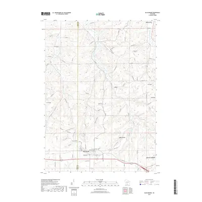
2018 Map of Blue Mounds
USGS Topo · Published 2018About this map
Blue Mounds and the western edge of Mount Horeb anchor this landscape along the Iowa and Dane County line. The terrain is defined by a series of distinct ridges and valleys, including Pleasant Valley, Bitsedalen, and Coulee Ridge, which channel the various branches of West Branch Blue Mounds Creek and East Branch Blue Mounds Creek. Small settlements and cultural sites are scattered throughout these hills, such as the historic Little Norway and the Saint James Catholic Cemetery.
Find a feature on this map
82 named features on this map. Tap any name to fly to it.
Don’t see what you’re looking for? This feature index may not catch every label — zoom into the map to look around manually.
Map Details
Editions of this 2018 Blue Mounds Map
This is the sole edition of this map. No revisions or reprints were ever made.
Other maps of this area

1907 · Cross Plains
USGS Topo · 1:62,500

1909 · Cross Plains
USGS Topo · 1:62,500

1920 · Blue Mounds
USGS Topo · 1:62,500

1922 · Blue Mounds
USGS Topo · 1:62,500

1923 · Blanchardville
USGS Topo · 1:62,500

1923 · New Glarus
USGS Topo · 1:62,500

1954 · Rockford
USGS Topo · 1:250,000

1955 · Rockford
USGS Topo · 1:250,000

1957 · Madison
USGS Topo · 1:250,000

1958 · Rockford
USGS Topo · 1:250,000