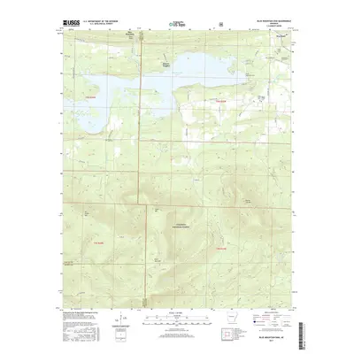
2017 Map of Blue Mountain Dam
USGS Topo · Published 2017About this map
Blue Mountain Dam and the waters of Blue Mountain Lake anchor this landscape along the Logan and Yell County line. The reservoir is fed by the Petit Jean River and surrounded by a cluster of family-named landmarks and cemeteries, including the Rock Creek Cem and Alexander A Scott Cem near the settlement of Waveland. The terrain is defined by dramatic ridgelines such as Potts Ridge and Potato Hill Mtn, which rise above the surrounding valleys.
Find a feature on this map
63 named features on this map. Tap any name to fly to it.
Don’t see what you’re looking for? This feature index may not catch every label — zoom into the map to look around manually.
Map Details
Editions of this 2017 Blue Mountain Dam Map
This is the sole edition of this map. No revisions or reprints were ever made.
Other maps of this area

1879 · Mountain Home
USGS Topo · 1:62,500

1887 · Magazine Mountain #4
USGS Topo · 1:62,500

1887 · Mount Ida #2
USGS Topo · 1:62,500

1887 · Magazine Mountain #3
USGS Topo · 1:62,500

1887 · Magazine Mountain
USGS Topo · 1:62,500

1890 · Magazine Mountain
USGS Topo · 1:125,000

1890 · Mount Ida
USGS Topo · 1:125,000

1934 · Booneville
USGS Topo · 1:48,000

1939 · Booneville
USGS Topo · 1:62,500

1955 · Little Rock
USGS Topo · 1:250,000