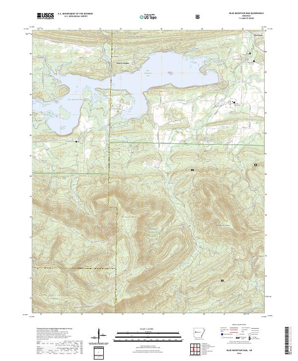
2024 Map of Blue Mountain Dam
USGS Topo · Published 2024About this map
Blue Mountain Lake dominates the northern landscape of this region where Logan, Yell, and Scott Counties converge. The Petit Jean River flows into the reservoir near Waveland, a settlement marked by a concentration of local heritage sites including Rock Creek Cem and Alexander A Scott Cem. The terrain rises sharply to the south, transitioning from the water-carved valleys of Cedar Creek and Ladds Creek into the protected timberlands of the Ouachita National Forest. This modern survey illustrates the proximity of residential pockets like Quarry Heights to the primitive landscape of the Dry Creek Wilderness. Genealogists will find several family-named burial grounds preserved in the topography, such as Small Smith Cem and Moores Chapel Cem, which anchor the history of these upland communities between Potts Ridge and Potato Hill Mtn.
Find a feature on this map
60 named features on this map. Tap any name to fly to it.
Don’t see what you’re looking for? This feature index may not catch every label — zoom into the map to look around manually.
Map Details
Editions of this 2024 Blue Mountain Dam Map
This is the sole edition of this map. No revisions or reprints were ever made.
Other maps of this area

1879 · Mountain Home
USGS Topo · 1:62,500

1887 · Magazine Mountain #4
USGS Topo · 1:62,500

1887 · Mount Ida #2
USGS Topo · 1:62,500

1887 · Magazine Mountain #3
USGS Topo · 1:62,500

1887 · Magazine Mountain
USGS Topo · 1:62,500

1890 · Magazine Mountain
USGS Topo · 1:125,000

1890 · Mount Ida
USGS Topo · 1:125,000

1934 · Booneville
USGS Topo · 1:48,000

1939 · Booneville
USGS Topo · 1:62,500

1955 · Little Rock
USGS Topo · 1:250,000