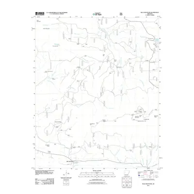
2011 Map of Blue Mountain
USGS Topo · Published 2011About this map
The town of Blue Mountain sits at the base of a high-elevation Arkansas landscape dominated by the northern slopes of the Mount Magazine area. This 2011 survey details a region defined by its springs and recreational infrastructure, notably the Magazine Mountain Lodge and Magazine Lookout Tower atop Signal Mountain. The hydrology is complex, with numerous family-named springs like Burnett Spring, Brown Spring, and Ball Spring feeding a network of creeks including Revillee Creek and Short Mountain Creek.
Find a feature on this map
66 named features on this map. Tap any name to fly to it.
Don’t see what you’re looking for? This feature index may not catch every label — zoom into the map to look around manually.
Map Details
Editions of this 2011 Blue Mountain Map
This is the sole edition of this map. No revisions or reprints were ever made.
Other maps of this area

1879 · Mountain Home
USGS Topo · 1:62,500

1887 · Magazine Mountain #1
USGS Topo · 1:62,500

1887 · Magazine Mountain #4
USGS Topo · 1:62,500

1887 · Magazine Mountain #2
USGS Topo · 1:62,500

1887 · Magazine Mountain #3
USGS Topo · 1:62,500

1887 · Magazine Mountain
USGS Topo · 1:62,500

1890 · Magazine Mountain
USGS Topo · 1:125,000

1934 · Booneville
USGS Topo · 1:48,000

1939 · Booneville
USGS Topo · 1:62,500

1956 · Russellville
USGS Topo · 1:250,000