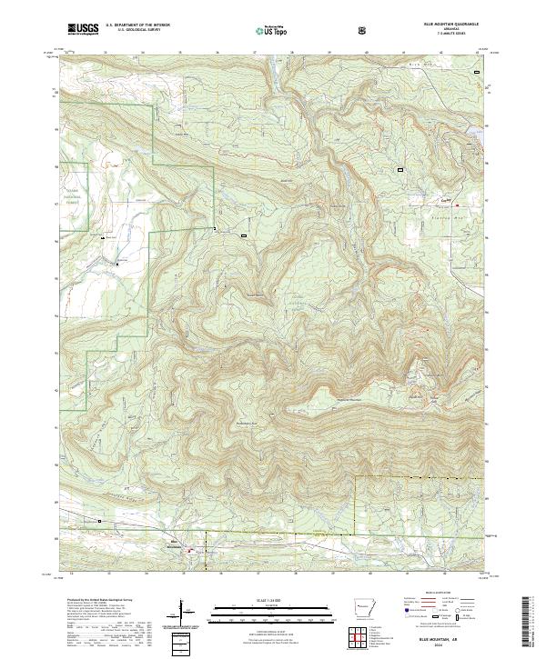
2024 Map of Blue Mountain
USGS Topo · Published 2024About this map
Magazine Mountain dominates this terrain, rising above the surrounding landscape with its prominent Signal Hill and Cameron Bluff. The area reflects a classic Ozark forest-and-valley settlement pattern, where small communities like Corley and Blue Mountain are connected by winding mountain roads and trails. Genealogists will find a cluster of rural burial sites, including Jenkins Cem, Rana Cem, and Shaw Cem near Revillee Creek, alongside Little Hope Cem further east.
Find a feature on this map
77 named features on this map. Tap any name to fly to it.
Don’t see what you’re looking for? This feature index may not catch every label — zoom into the map to look around manually.
Map Details
Editions of this 2024 Blue Mountain Map
This is the sole edition of this map. No revisions or reprints were ever made.
Other maps of this area

1879 · Mountain Home
USGS Topo · 1:62,500

1887 · Magazine Mountain #1
USGS Topo · 1:62,500

1887 · Magazine Mountain #4
USGS Topo · 1:62,500

1887 · Magazine Mountain #2
USGS Topo · 1:62,500

1887 · Magazine Mountain #3
USGS Topo · 1:62,500

1887 · Magazine Mountain
USGS Topo · 1:62,500

1890 · Magazine Mountain
USGS Topo · 1:125,000

1934 · Booneville
USGS Topo · 1:48,000

1939 · Booneville
USGS Topo · 1:62,500

1956 · Russellville
USGS Topo · 1:250,000