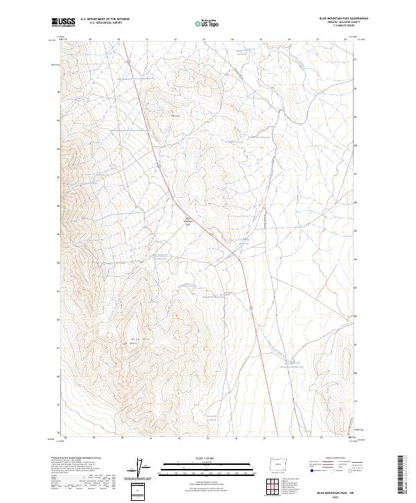
2023 Map of Blue Mountain Pass
USGS Topo · Published 2023About this map
Blue Mountain Pass serves as a critical geographic corridor through the high-desert terrain of southeastern Malheur County. This 2023 survey illustrates an arid landscape defined by water management, where numerous seasonal catchments like Basque Flat Reservoir and Long Draw Reservoir support ranching operations. The rugged topography is punctuated by prominent landmarks such as The Cap and the broad plateau of The Table, while Horse Corral Creek winds through the drainages. The distribution of features like Wash Rock Spring and the sequenced Blue Mountain Reservoir Number One through Blue Mountain Reservoir Number Five highlights the essential infrastructure required for survival and industry in this isolated stretch of Oregon.
Find a feature on this map
24 named features on this map. Tap any name to fly to it.
Don’t see what you’re looking for? This feature index may not catch every label — zoom into the map to look around manually.
Map Details
Editions of this 2023 Blue Mountain Pass Map
This is the sole edition of this map. No revisions or reprints were ever made.
Other maps of this area

1955 · Jordan Valley
USGS Topo · 1:250,000

1957 · Jordan Valley
USGS Topo · 1:250,000

1958 · Jordan Valley
USGS Topo · 1:250,000

1982 · Battle Mtn
USGS Topo · 1:24,000
1982 · Oregon Canyon Ranch
USGS Topo · 1:24,000
1982 · Bowden Waterhole
USGS Topo · 1:24,000
1982 · Jackson Summit
USGS Topo · 1:24,000
1982 · Basque
USGS Topo · 1:24,000
1982 · Battle Creek Ranch
USGS Topo · 1:24,000
1982 · Three Man Butte Well
USGS Topo · 1:24,000