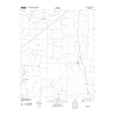
2010 Map of Blue Ridge
USGS Topo · Published 2010About this map
Westminster and Blue Ridge anchor this Collin County landscape, connected by a network of farm-to-market roads and county routes that follow the gentle drainage basins of north-central Texas. The map reveals a high density of small rural communities and named crossroads, including Valdasta, Chambliss, and Fayburg, many of which maintain their own community burial grounds such as the Westminster Cemetery and Blue Ridge Cemetery.
Find a feature on this map
58 named features on this map. Tap any name to fly to it.
Don’t see what you’re looking for? This feature index may not catch every label — zoom into the map to look around manually.
Map Details
Editions of this 2010 Blue Ridge Map
This is the sole edition of this map. No revisions or reprints were ever made.
Other maps of this area

1929 · McKinney
USGS Topo · 1:62,500

1930 · Farmersville
USGS Topo · 1:62,500

1954 · Sherman
USGS Topo · 1:250,000

1958 · Sherman
USGS Topo · 1:250,000

1960 · McKinney East
USGS Topo · 1:24,000

1960 · Blue Ridge
USGS Topo · 1:24,000

1960 · Pike
USGS Topo · 1:24,000

1960 · Culleoka
USGS Topo · 1:24,000

1961 · Van Alstyne
USGS Topo · 1:24,000
1961 · Anna
USGS Topo · 1:24,000