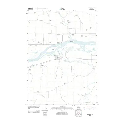
2010 Map of Blue River
USGS Topo · Published 2010About this map
The Wisconsin River dominates this landscape as it flows between Port Andrew and the village of Blue River. In this part of the Driftless Area, the topography is defined by prominent ridges and deep hollows, including Strawberry Ridge, Oak Ridge, and Studenberg Hollow. The map provides significant genealogical value through its documentation of numerous burial grounds such as Greenwood Cemetery, Sand Prairie Cemetery, and Beulah Cemetery.
Find a feature on this map
62 named features on this map. Tap any name to fly to it.
Don’t see what you’re looking for? This feature index may not catch every label — zoom into the map to look around manually.
Map Details
Editions of this 2010 Blue River Map
This is the sole edition of this map. No revisions or reprints were ever made.
Other maps of this area

1905 · Richland Center
USGS Topo · 1:125,000

1933 · Boaz
USGS Topo · 1:62,500

1933 · Boscobel
USGS Topo · 1:62,500

1958 · La Crosse
USGS Topo · 1:250,000

1960 · Richland Center
USGS Topo · 1:62,500

1960 · Muscoda
USGS Topo · 1:62,500

1961 · La Crosse
USGS Topo · 1:250,000

1965 · La Crosse
USGS Topo · 1:250,000

1966 · Boaz
USGS Topo · 1:62,500
1967 · Boscobel
USGS Topo · 1:62,500