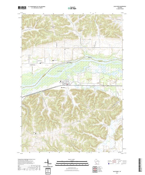
2022 Map of Blue River
USGS Topo · Published 2022About this map
Steamboat Island and Coumbe Island divide the waters of the Wisconsin River as it winds through the borderlands of Richland and Grant Counties. The topography here is defined by deeply carved coulees and ridges, including the prominent Strawberry Ridge and Oak Ridge, which frame narrow valleys like Taylor Hollow and Studenberg Hollow. The small community of Blue River sits on the southern bank, supported by a network of drainage features like Cross Slough and Jones Slough. A cluster of well-preserved local burial grounds, such as Greenwood Cem and Sand Prairie Cem, offers significant research value for those tracing family ties in the driftless area's rural settlements. These sites are linked by early roads such as Sand Prairie School Drive, reflecting the region's agricultural and educational heritage.
Find a feature on this map
58 named features on this map. Tap any name to fly to it.
Don’t see what you’re looking for? This feature index may not catch every label — zoom into the map to look around manually.
Map Details
Editions of this 2022 Blue River Map
This is the sole edition of this map. No revisions or reprints were ever made.
Other maps of this area

1905 · Richland Center
USGS Topo · 1:125,000

1933 · Boaz
USGS Topo · 1:62,500

1933 · Boscobel
USGS Topo · 1:62,500

1958 · La Crosse
USGS Topo · 1:250,000

1960 · Richland Center
USGS Topo · 1:62,500

1960 · Muscoda
USGS Topo · 1:62,500

1961 · La Crosse
USGS Topo · 1:250,000

1965 · La Crosse
USGS Topo · 1:250,000

1966 · Boaz
USGS Topo · 1:62,500
1967 · Boscobel
USGS Topo · 1:62,500