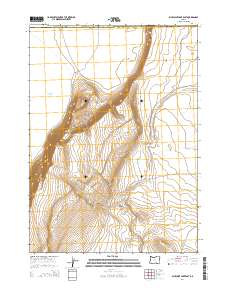
2014 Map of Bluejoint Lake East
USGS Topo · Published 2014About this map
Warner Valley defines the western expanse of this high desert landscape, where the seasonal waters of Bluejoint Lake sit against a dramatic rise in elevation. The terrain is dominated by the massive escarpment of Poker Jim Ridge, which cuts diagonally across the center of the sheet, separating the lower basin from the higher tablelands to the east. This transition is further marked by deep erosional features like Snyder Canyon, which carves into the eastern highlands.
Find a feature on this map
11 named features on this map. Tap any name to fly to it.
Don’t see what you’re looking for? This feature index may not catch every label — zoom into the map to look around manually.
Map Details
Editions of this 2014 Bluejoint Lake East Map
This is the sole edition of this map. No revisions or reprints were ever made.
Other maps of this area

1955 · Adel
USGS Topo · 1:250,000

1957 · Adel
USGS Topo · 1:250,000

1958 · Adel
USGS Topo · 1:250,000

1962 · Adel
USGS Topo · 1:250,000

1966 · Bluejoint Lake East
USGS Topo · 1:24,000

1967 · Campbell Lake
USGS Topo · 1:24,000

1967 · Flook Lake
USGS Topo · 1:24,000

1967 · Bluejoint Lake West
USGS Topo · 1:24,000

1971 · Steamboat Point
USGS Topo · 1:24,000

1971 · Murphy Waterholes
USGS Topo · 1:24,000