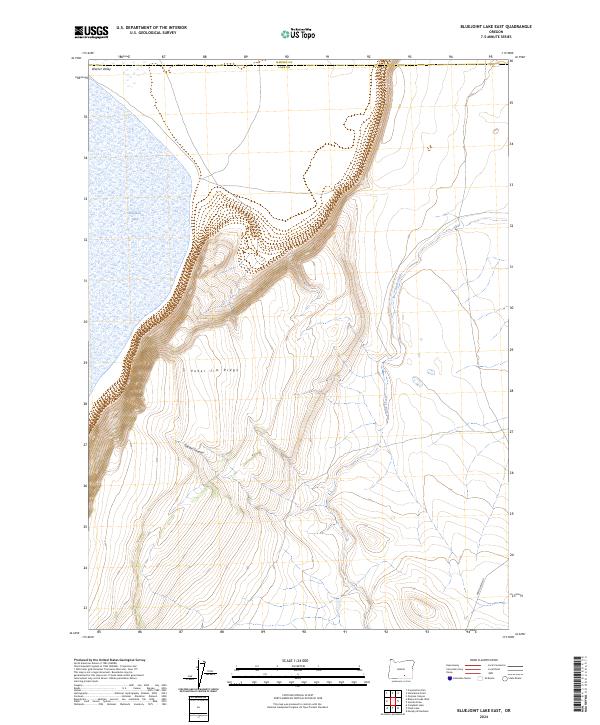
2024 Map of Bluejoint Lake East
USGS Topo · Published 2024About this map
Hart Mountain National Antelope Refuge dominates the eastern high desert landscape, where the dramatic elevation changes of Poker Jim Ridge transition into the expansive flats of the Warner Valley. This 2024 survey documents a critical intersection of hydrology and topography, capturing the seasonal character of Bluejoint Lake and the drainage patterns of Rock Creek as they navigate the rimrocks. The rugged verticality of the escarpment is punctuated by Snyder Canyon, providing a detailed view of the natural corridors that define this protected habitat. In the far southeastern corner, Frenchglen Rd serves as the primary artery through this isolated terrain, crossing the boundary between Lake and Harney Counties.
Find a feature on this map
13 named features on this map. Tap any name to fly to it.
Don’t see what you’re looking for? This feature index may not catch every label — zoom into the map to look around manually.
Map Details
Editions of this 2024 Bluejoint Lake East Map
This is the sole edition of this map. No revisions or reprints were ever made.
Other maps of this area

1955 · Adel
USGS Topo · 1:250,000

1957 · Adel
USGS Topo · 1:250,000

1958 · Adel
USGS Topo · 1:250,000

1962 · Adel
USGS Topo · 1:250,000

1966 · Bluejoint Lake East
USGS Topo · 1:24,000

1967 · Campbell Lake
USGS Topo · 1:24,000

1967 · Flook Lake
USGS Topo · 1:24,000

1967 · Bluejoint Lake West
USGS Topo · 1:24,000

1971 · Steamboat Point
USGS Topo · 1:24,000

1971 · Murphy Waterholes
USGS Topo · 1:24,000