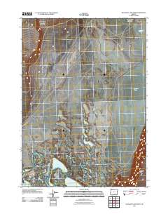
2011 Map of Bluejoint Lake West
USGS Topo · Published 2011About this map
Bluejoint Lake dominates the eastern basin of this high desert landscape in Harney County, illustrating the seasonal and ephemeral nature of Oregon's Great Basin hydrology. The map centers on the Bluejoint Ranch and a network of unimproved roads that trace the contours of a sparsely populated ranching interior. To the south and west, the terrain is punctuated by smaller water bodies like Turpin Lake and Stone Corral Lake, which occupy the low points of the scrubland. This 2011 survey captures the area before modern shifts in land use, showing the relationship between isolated ranching infrastructure and the prominent rise of Poker Jim Ridge to the southeast. The survey provides a clear view of the land as it remained defined by traditional grazing boundaries and the natural catchment of the high desert basins.
Find a feature on this map
5 named features on this map. Tap any name to fly to it.
Don’t see what you’re looking for? This feature index may not catch every label — zoom into the map to look around manually.
Map Details
Editions of this 2011 Bluejoint Lake West Map
This is the sole edition of this map. No revisions or reprints were ever made.
Other maps of this area

1955 · Adel
USGS Topo · 1:250,000

1957 · Adel
USGS Topo · 1:250,000

1958 · Adel
USGS Topo · 1:250,000

1962 · Adel
USGS Topo · 1:250,000

1966 · Bluejoint Lake East
USGS Topo · 1:24,000

1966 · Rabbit Hills NE
USGS Topo · 1:24,000

1967 · Flagstaff Lake
USGS Topo · 1:24,000

1967 · Campbell Lake
USGS Topo · 1:24,000

1967 · Flook Lake
USGS Topo · 1:24,000

1967 · Bluejoint Lake West
USGS Topo · 1:24,000