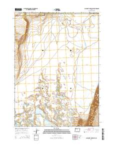
2014 Map of Bluejoint Lake West
USGS Topo · Published 2014About this map
Warner Valley and the steep eastern escarpment of Poker Jim Ridge dominate this portion of the high desert along the border of Harney and Lake counties. The landscape is defined by its interior drainage system, where intermittent water bodies like Bluejoint Lake, Turpin Lake, and Stone Corral Lake collect in the basin. These alkaline lake beds and seasonal wetlands reflect the complex hydrography of the Great Basin, where water levels fluctuate significantly across the seasons. Primitive routes such as Flagstaff Lk and Blue Joint provide the primary access through this arid terrain, following the natural contours of the valley floor. To the north, the prominent landmark of Black Cap rises above the valley, serving as a navigational point in an otherwise expansive and open landscape that has seen little structural development.
Find a feature on this map
10 named features on this map. Tap any name to fly to it.
Don’t see what you’re looking for? This feature index may not catch every label — zoom into the map to look around manually.
Map Details
Editions of this 2014 Bluejoint Lake West Map
This is the sole edition of this map. No revisions or reprints were ever made.
Other maps of this area

1955 · Adel
USGS Topo · 1:250,000

1957 · Adel
USGS Topo · 1:250,000

1958 · Adel
USGS Topo · 1:250,000

1962 · Adel
USGS Topo · 1:250,000

1966 · Bluejoint Lake East
USGS Topo · 1:24,000

1966 · Rabbit Hills NE
USGS Topo · 1:24,000

1967 · Flagstaff Lake
USGS Topo · 1:24,000

1967 · Campbell Lake
USGS Topo · 1:24,000

1967 · Flook Lake
USGS Topo · 1:24,000

1967 · Bluejoint Lake West
USGS Topo · 1:24,000