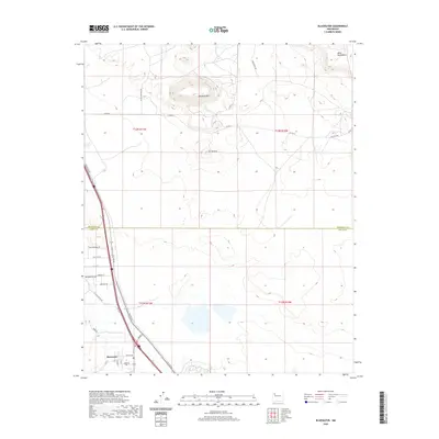
2020 Map of Bluewater
USGS Topo · Published 2020About this map
Bluewater sits along the southern edge of this quadrangle, where the street grid of Center Ave and Main St meets the historic corridor of Hst Rte 66. The landscape north of the settlement transitions from the drainage of Mitchell Draw into a high-desert terrain marked by volcanic and mesa formations. Significant topographical landmarks like Haystack Mtn and the cinder cone of El Tintero rise above the surrounding plateau, providing clear orientation points for this section of the Colorado Plateau. The northern boundary of the map is dominated by the broad elevation of Mesa Montanosa. Local travel is documented through a network of rural routes such as Little Mountain Rd and Haystack Rd, while the political boundary of the McKinley Co Cibola Co line bisects the territory, reflecting the administrative divisions of this high-altitude region.
Find a feature on this map
33 named features on this map. Tap any name to fly to it.
Don’t see what you’re looking for? This feature index may not catch every label — zoom into the map to look around manually.
Map Details
Editions of this 2020 Bluewater Map
This is the sole edition of this map. No revisions or reprints were ever made.
Other maps of this area

1883 · Mt. Taylor
USGS Topo · 1:250,000

1886 · Wingate
USGS Topo · 1:250,000

1886 · Mt. Taylor
USGS Topo · 1:250,000

1892 · Wingate
USGS Topo · 1:250,000

1892 · Mt. Taylor
USGS Topo · 1:250,000

1899 · Mt. Taylor
USGS Topo · 1:250,000

1951 · Mt Sedgwick
USGS Topo · 1:24,000

1954 · Gallup
USGS Topo · 1:250,000

1957 · Ambrosia Lake
USGS Topo · 1:24,000

1957 · Dos Lomas
USGS Topo · 1:24,000