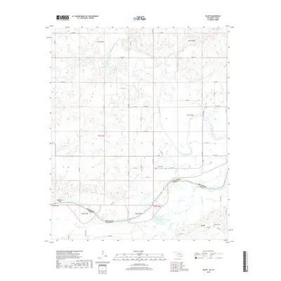
2018 Map of Bluff
USGS Topo · Published 2018About this map
The Red River defines the border between Oklahoma and Texas in this modern survey, where the winding waterway separates Choctaw and Lamar counties. This riparian landscape is characterized by a complex network of seasonal creeks and wetlands, including the expansive Muddy Boggy Creek and Bokchito Creek systems that feed into the river valley. The map documents the rural settlement patterns near the state line, anchored by the community of Razor and the high ground of Garretts Bluff. Genealogists and local historians will find several burial sites preserved in the landscape, such as Bluff Cem, Reid Cem, and Macedonia Cem. The terrain is a mix of lowland basins like Palmer Lake and elevated ridges defined by small tributaries such as Dead Man Branch and Pole Creek, reflecting the traditional agricultural grid of East 2000-series roads.
Find a feature on this map
34 named features on this map. Tap any name to fly to it.
Don’t see what you’re looking for? This feature index may not catch every label — zoom into the map to look around manually.
Map Details
Editions of this 2018 Bluff Map
This is the sole edition of this map. No revisions or reprints were ever made.
Other maps of this area

1901 · Antlers
USGS Topo · 1:125,000

1903 · Paris
USGS Topo · 1:125,000

1912 · Antlers
USGS Topo · 1:125,000

1925 · Antlers
USGS Topo · 1:125,000

1948 · Grant
USGS Topo · 1:62,500

1948 · Direct
USGS Topo · 1:62,500

1949 · Direct
USGS Topo · 1:62,500

1949 · Grant
USGS Topo · 1:62,500

1950 · Mcalester
USGS Topo · 1:250,000

1953 · Texarkana
USGS Topo · 1:250,000