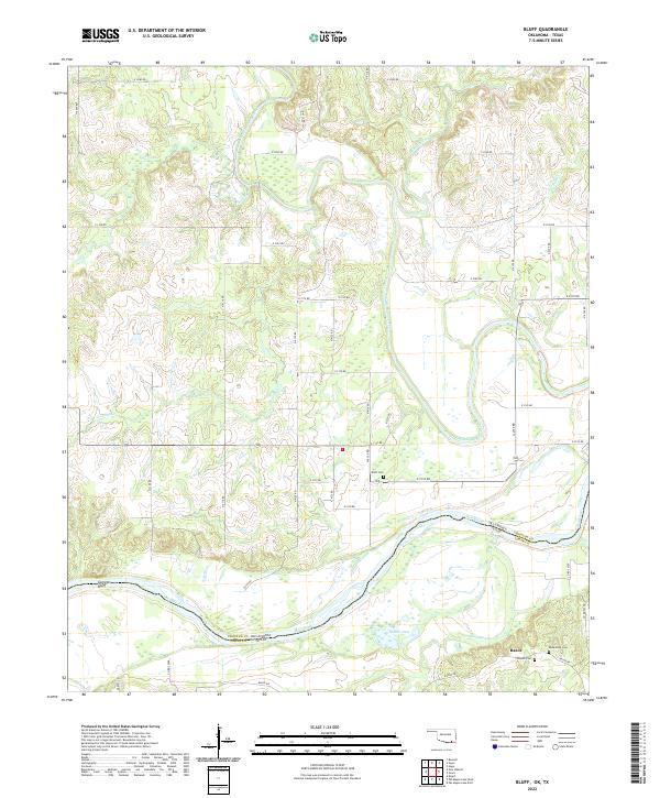
2022 Map of Bluff
USGS Topo · Published 2022About this map
The Red River defines the southern boundary of this landscape, separating Choctaw County, Oklahoma from Lamar County, Texas. The confluence of several significant waterways occurs here, with Muddy Boggy Creek and its many tributaries, such as Bokchito Creek and Crooked Cr, draining southward toward the main river channel. The topography is marked by the prominent Garretts Bluff overlooking the river valley, while the inland areas feature numerous small wetlands and oxbow formations like Palmer Lake and Dead Man Br.
Find a feature on this map
47 named features on this map. Tap any name to fly to it.
Don’t see what you’re looking for? This feature index may not catch every label — zoom into the map to look around manually.
Map Details
Editions of this 2022 Bluff Map
This is the sole edition of this map. No revisions or reprints were ever made.
Other maps of this area

1901 · Antlers
USGS Topo · 1:125,000

1903 · Paris
USGS Topo · 1:125,000

1912 · Antlers
USGS Topo · 1:125,000

1925 · Antlers
USGS Topo · 1:125,000

1948 · Grant
USGS Topo · 1:62,500

1948 · Direct
USGS Topo · 1:62,500

1949 · Direct
USGS Topo · 1:62,500

1949 · Grant
USGS Topo · 1:62,500

1950 · Mcalester
USGS Topo · 1:250,000

1953 · Texarkana
USGS Topo · 1:250,000