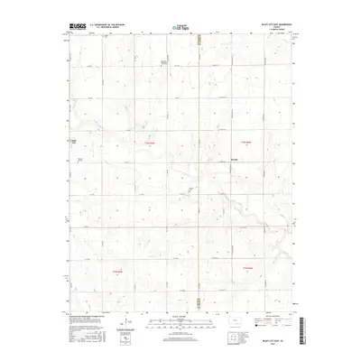
2015 Map of Bluff City East
USGS Topo · Published 2015About this map
The Harper and Sumner county line divides this agricultural landscape on the Kansas-Oklahoma border, where the prairie begins its descent into the drainage of Bluff Creek. This 2015 survey reveals a terrain defined by a strict section-line road grid, centered on the small community of Bluff City. Local history and genealogy are anchored by several rural burial grounds, including the Singer Cemetery in the northwest and the Saint Paul Evangelical Church Cemetery, which marks a site of early German Lutheran heritage. The map also identifies the location of Metcalf, situated along S Blackstone Road. This modern record of the area preserves the names of small tributaries like Spring Branch and Fall Creek, alongside the family-named roads that continue to define the ranching and farming tracts of south-central Kansas.
Find a feature on this map
43 named features on this map. Tap any name to fly to it.
Don’t see what you’re looking for? This feature index may not catch every label — zoom into the map to look around manually.
Map Details
Editions of this 2015 Bluff City East Map
This is the sole edition of this map. No revisions or reprints were ever made.
Other maps of this area

1889 · Caldwell
USGS Topo · 1:125,000

1893 · Caldwell
USGS Topo · 1:125,000

1897 · Caldwell
USGS Topo · 1:125,000

1955 · Wichita
USGS Topo · 1:250,000

1955 · Enid
USGS Topo · 1:250,000

1958 · Enid
USGS Topo · 1:250,000

1958 · Wichita
USGS Topo · 1:250,000

1968 · Wakita
USGS Topo · 1:24,000

1968 · Renfrow
USGS Topo · 1:24,000
1968 · Wakita NE
USGS Topo · 1:24,000