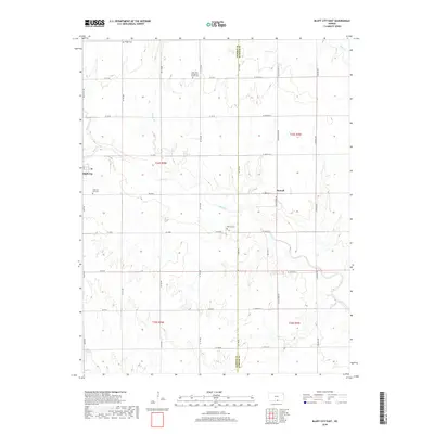
2018 Map of Bluff City East
USGS Topo · Published 2018About this map
Bluff City sits at the western edge of this landscape, marking a transition into the rural section-line grids that define the border between Harper and Sumner counties. The terrain is deeply etched by the meandering course of Bluff Cr, which flows eastward across the center of the sheet, joined by smaller tributaries like Baehr Cr and Spring Br. This agricultural region is punctuated by small, family-linked landmarks and centers of worship, notably the Saint Paul Evangelical Church Cem and Singer Cem in the north.
Find a feature on this map
45 named features on this map. Tap any name to fly to it.
Don’t see what you’re looking for? This feature index may not catch every label — zoom into the map to look around manually.
Map Details
Editions of this 2018 Bluff City East Map
This is the sole edition of this map. No revisions or reprints were ever made.
Other maps of this area

1889 · Caldwell
USGS Topo · 1:125,000

1893 · Caldwell
USGS Topo · 1:125,000

1897 · Caldwell
USGS Topo · 1:125,000

1955 · Wichita
USGS Topo · 1:250,000

1955 · Enid
USGS Topo · 1:250,000

1958 · Enid
USGS Topo · 1:250,000

1958 · Wichita
USGS Topo · 1:250,000

1968 · Wakita
USGS Topo · 1:24,000

1968 · Renfrow
USGS Topo · 1:24,000
1968 · Wakita NE
USGS Topo · 1:24,000