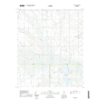
2021 Map of Bluff Lake
USGS Topo · Published 2021About this map
The Noxubee River meanders through a sprawling wetland landscape where the borders of Oktibbeha, Winston, and Noxubee counties converge. This environment is defined by an intricate network of waterways, including Bluff Lake and Loakfoma Lake, alongside specialized managed areas like Green Timber Reservoir Number One. The presence of Griffin Slough and Dickerson Arm illustrates the complex drainage patterns of the lowlands, while the Jordan Canal suggests historical efforts to manage these waters.
Find a feature on this map
71 named features on this map. Tap any name to fly to it.
Don’t see what you’re looking for? This feature index may not catch every label — zoom into the map to look around manually.
Map Details
Editions of this 2021 Bluff Lake Map
This is the sole edition of this map. No revisions or reprints were ever made.
Other maps of this area

1953 · West Point
USGS Topo · 1:250,000

1958 · West Point
USGS Topo · 1:250,000

1959 · Artesia
USGS Topo · 1:62,500

1963 · West Point
USGS Topo · 1:250,000

1965 · Starkville
USGS Topo · 1:24,000

1965 · Bluff Lake
USGS Topo · 1:24,000

1965 · Longview
USGS Topo · 1:24,000

1965 · Bradley
USGS Topo · 1:24,000
1973 · Barge Lake
USGS Topo · 1:24,000
1973 · Betheden
USGS Topo · 1:24,000