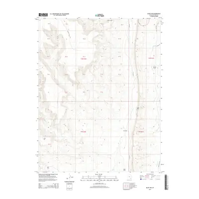
2014 Map of Bluff NW
USGS Topo · Published 2014About this map
Comb Ridge dominates the eastern half of this landscape, creating a dramatic geologic boundary that separates the drainage of S Comb Wash from the expansive plateau to the west. This canyon country is defined by deeply incised drainages, where Fish Cr and Mule Canyon have carved complex paths through the sandstone layers. To the east, Butler Wash and Lower Butler Wash run parallel to the ridge, serving as a corridor for Co Road 233. This 2014 survey documents the isolated desert terrain including Snow Flat and the intricate switchbacks of The Twist. The presence of reliable water sources like Sweet Springs suggests the historical importance of these canyons for movement through this arid portion of San Juan County.
Find a feature on this map
38 named features on this map. Tap any name to fly to it.
Don’t see what you’re looking for? This feature index may not catch every label — zoom into the map to look around manually.
Map Details
Editions of this 2014 Bluff NW Map
This is the sole edition of this map. No revisions or reprints were ever made.
Other maps of this area

1886 · Abajo
USGS Topo · 1:250,000

1892 · Abajo
USGS Topo · 1:250,000

1893 · Abajo
USGS Topo · 1:250,000

1935 · Elk Ridge
USGS Topo · 1:96,000

1940 · Elk Ridge
USGS Topo · 1:125,000

1954 · Elk Ridge 3 SE
USGS Topo · 1:24,000

1954 · Bears Ears
USGS Topo · 1:62,500

1956 · Cortez
USGS Topo · 1:250,000

1957 · Elk Ridge 4 SE
USGS Topo · 1:24,000

1957 · Brushy Basin Wash
USGS Topo · 1:62,500