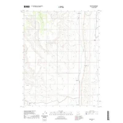
2020 Map of Bluff NW
USGS Topo · Published 2020About this map
Comb Ridge dominates the eastern portion of this San Juan County landscape, serving as a massive monocline that dictates the drainage patterns of the surrounding high desert. The map illustrates a network of seasonal watercourses and canyons, including Mule Canyon and Stevens Canyon, which feed into the primary north-south arteries of Butler Wash and Comb Wash. The terrain is characterized by geological formations such as Snow Flat and the winding passage known as The Twist in the southwest corner. Sparse vehicular access is limited to unpaved routes like Comb Wash Rd and Co Rd 262, which follow the natural contours of the washes. This 2020 survey captures the area's essential hydrography, from Sweet Springs to the intermittent flow of Fish Cr, highlighting the isolated nature of this corner of the Colorado Plateau.
Find a feature on this map
15 named features on this map. Tap any name to fly to it.
Don’t see what you’re looking for? This feature index may not catch every label — zoom into the map to look around manually.
Map Details
Editions of this 2020 Bluff NW Map
This is the sole edition of this map. No revisions or reprints were ever made.
Other maps of this area

1886 · Abajo
USGS Topo · 1:250,000

1892 · Abajo
USGS Topo · 1:250,000

1893 · Abajo
USGS Topo · 1:250,000

1935 · Elk Ridge
USGS Topo · 1:96,000

1940 · Elk Ridge
USGS Topo · 1:125,000

1954 · Elk Ridge 3 SE
USGS Topo · 1:24,000

1954 · Bears Ears
USGS Topo · 1:62,500

1956 · Cortez
USGS Topo · 1:250,000

1957 · Elk Ridge 4 SE
USGS Topo · 1:24,000

1957 · Brushy Basin Wash
USGS Topo · 1:62,500