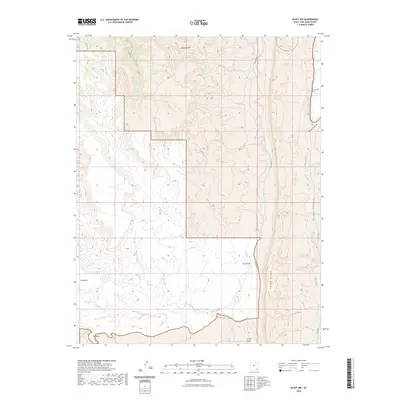
2023 Map of Bluff NW
USGS Topo · Published 2023About this map
Comb Ridge dominates the eastern half of this landscape, creating a dramatic linear barrier that defines the local drainage patterns. To the west, the high plateau of Snow Flat sits above a complex network of canyons and washes, including the deep incisions of Mule Canyon and Fish Creek. This area of San Juan County is marked by its remote character, where access is limited to rugged tracks like Comb Wash Rd and various county roads such as Co RD 236. The map illustrates a transition from the broad, open flats to the confined corridors of Butler Canyon and Stevens Canyon, revealing how the topography dictated travel routes through features like The Twist. Rare water sources, such as Sweet Springs, appear as vital points in this otherwise arid environment.
Find a feature on this map
16 named features on this map. Tap any name to fly to it.
Don’t see what you’re looking for? This feature index may not catch every label — zoom into the map to look around manually.
Map Details
Editions of this 2023 Bluff NW Map
This is the sole edition of this map. No revisions or reprints were ever made.
Other maps of this area

1886 · Abajo
USGS Topo · 1:250,000

1892 · Abajo
USGS Topo · 1:250,000

1893 · Abajo
USGS Topo · 1:250,000

1935 · Elk Ridge
USGS Topo · 1:96,000

1940 · Elk Ridge
USGS Topo · 1:125,000

1954 · Elk Ridge 3 SE
USGS Topo · 1:24,000

1954 · Bears Ears
USGS Topo · 1:62,500

1956 · Cortez
USGS Topo · 1:250,000

1957 · Elk Ridge 4 SE
USGS Topo · 1:24,000

1957 · Brushy Basin Wash
USGS Topo · 1:62,500