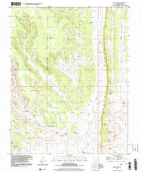
1996 Map of Bluff NW
USGS Topo · Published 2002About this map
Comb Ridge dominates this high-desert landscape in San Juan County, Utah, where a complex network of canyons and washes reveals a rich archaeological record. Numerous sites marked as Cliff Dwelling, Cliff Dwellings, and Ruins are clustered along the drainage systems of Mule Canyon and Fish Creek. These features indicate a deeply layered human history, centered on the reliable water sources of Cliff Dwellings Spring and Sweet Springs. In the southern reaches, the Mormon Trail winds through The Twist, a significant geographical obstacle for early pioneers and travelers navigating the sandstone terrain between Snow Flat and Comb Wash. The presence of several Drill Hole locations and a remote Landing Strip suggests mid-century exploration and infrastructure development in an otherwise isolated environment.
Find a feature on this map
21 named features on this map. Tap any name to fly to it.
Don’t see what you’re looking for? This feature index may not catch every label — zoom into the map to look around manually.
Map Details
Editions of this 1996 Bluff NW Map
This is the sole edition of this map. No revisions or reprints were ever made.
Other maps of this area

1886 · Abajo
USGS Topo · 1:250,000

1892 · Abajo
USGS Topo · 1:250,000

1893 · Abajo
USGS Topo · 1:250,000

1935 · Elk Ridge
USGS Topo · 1:96,000

1940 · Elk Ridge
USGS Topo · 1:125,000

1954 · Elk Ridge 3 SE
USGS Topo · 1:24,000

1954 · Bears Ears
USGS Topo · 1:62,500

1956 · Cortez
USGS Topo · 1:250,000

1957 · Elk Ridge 4 SE
USGS Topo · 1:24,000

1957 · Brushy Basin Wash
USGS Topo · 1:62,500